Indexed News on:

--the California "Mega-Park" Project

Tracking measurable success on preserving and connecting California's Parks & Wildlife Corridors

READ OUR EDITOR ON FACEBOOK: facebook.com/rex.frankel

Thursday, January 28, 2010

WCB 2/2010: State to help save 10,400 acres at February meeting...

-
State Wildlife Board opens checkbook a little

February 25, 2010
10:00 AM
State Capitol, Room 112
Sacramento, California 95814

https://nrmsecure.dfg.ca.gov/FileHandler.ashx?DocumentID=15856

If all purchases are completed, this would add 5699 acres to full ownership by the State and 4727 acres in conservation easements (where the land remains privately owned but the development rights are given up)

MAPS: https://nrm.dfg.ca.gov/FileHandler.ashx?DocumentID=25146

*7. Clear Lake Conservation Area, a donation from Lake County Watershed Protection District of a conservation easement over 102± acres of wetlands.

*9. Lower Colorado River Ecological Reserve, (Travis Donation) Riverside County
To consider the acceptance of a donation to the State of two parcels of land totaling 84± acres to protect cottonwood and mesquite woodlands and riparian habitat, located just east of Highway 95 and along the Lower Colorado River, near the City of Blythe, in Riverside County.

*10. Western Riverside County MSHСP , Expansion 1 Riverside County
acquire 49± acres adjacent to the City of Temecula

*11. Iron Mountain Wildlife Area, Expansion 4, San Diego County
acquire 311± acres as an expansion to the Department of Fish and Game’s Iron Mountain Wildlife area, for the purposes of protecting undisturbed grasslands, chaparral, oak woodlands, vernal pools and riparian habitat in the San Vicente Creek watershed, located near the community of Ramona, in San Diego County.

12. Sierra Crest Conservation Easement, $6,430,000, Phases I and II Sierra and Nevada Counties. A grant to the Truckee Donner Land Trust, subject to the availability of bond funds, for a cooperative project with the Department of Fish and Game and the Northern Sierra Partnership to acquire a conservation easement over 4,365± acres of commercial timber land to promote sustainable harvesting practices, secure wildlife migration corridors, and provide public access along a two mile section of the Pacific Crest Trail, located in the vicinity of Jackson Meadows Reservoir north of the Town of Truckee, in Nevada and Sierra Counties.

13. Holmstead Farms #4, Yuba County
acquisition of a conservation easement over 260± acres of privately-owned land for a cooperative project with Ducks Unlimited, Inc. to protect seasonal and semi-permanent wetlands and upland grasslands, located in the community of Loma Rica, in Yuba County.

15. Liberty Island, Solano and Yolo Counties
To consider the acceptance by the State of a donation of fee title to approximately 5,030 acres from the Trust for Public Land to protect riparian and upland delta habitat on Liberty Island, located just west of the Sacramento Deep Water Shipping Canal, south of the City of Davis, in Yolo and Solano Counties.

17. Willow Hole Conservation Area, Expansion 1, Riverside County
acquisition of 45± acres to protect and enhance existing regional wildlife linkages and aeolian and fluvial sand transport areas within the Coachella Valley Multiple Species Habitat Conservation Preserve reserve area, located southeast of Desert Hot Springs and north of Highway 10, in Riverside County.

18. San Diego County (Helix-Lambron and Wildcat Canyon) acquisitions of two properties totaling 180± acres

Tuesday, January 26, 2010

North SF Bay land trust needs $ to open land to public

-
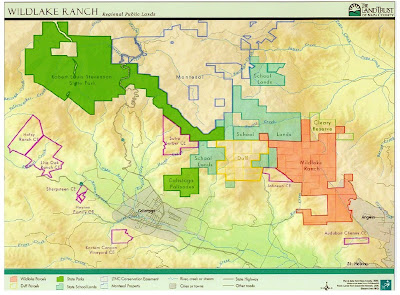
Napa Land Trust is still working to pay for 4000 acre Mountain


"the longest "mansion free" viewshed on any of the surrounding ranges in the Napa Valley."

http://www.napalandtrust.org/preserves/wildlake_duff.shtml

The Land Trust acquired Wildlake Duff for $25 million through our "Napa Valley Wild" capital campaign. We have raised all but $2.2 million and we need to raise an additional $700,000 for stewardship and administrative expenses.
----------------------------

http://www.napavalleyregister.com/news/local/article_eb66d6b0-dd63-5fd5-9939-ee4c499142a7.html

4/27/2009

...When the Land Trust bought the 4,000 acres on the Wildlake and Duff properties, the plan was to negotiate a sale to the state for the land to be used as a park with public access. The Land Trust’s “Napa Valley Wild” campaign raised $27 million to acquire the properties, of which $24 million was used to purchase the two pieces of land. ($2 million in state funds were contributed to the sale by the Coastal Conservancy.)

Yet the state’s financial problems have caused this process to stall indefinitely. Consequently, the Land Trust is now charged with the stewardship of the property....

Ultimately the goal was to add both new acquisitions to Robert Louis Stevenson State Park and create a 13,000-acre oasis of protected, undeveloped land....

--------------------------

for a map of preserved lands in Napa County:

https://blogger.googleusercontent.com/img/b/R29vZ2xl/AVvXsEjDGtgP5K_e5b_A5d_drXD9dugECAw-Te2JgVZCf_sMoywh2daFzOmrMYZxwjq6cBrSh7F6ObLDWANUITzr81XEfIiEz05WPwuwfbBVanECnA1BbCUEfHGwS-Y-ptc5ldMRXevyjlIFfBo/s1600-h/napa+county+2007+saved+o.s..jpg

Orange County's green vision...


What a green vision plan looks like in a county that's built-out:

Click on the map to enlarge.

to see the full size, 16 megabyte version of this map, click here:
http://fhbp.org/publications/green-vision-map.html

The areas in red shading are currently threatened with development. Notice how there's very little left that's threatened. Orange County had its last big bulldozer binge starting 20 years ago when the Irvine Company which owned the middle 1/5th of the county decided to try to pave the hills that surrounded their former orange groves, which they had paved in the previous 15 years. After long battles, the Irvine co.settled for a few choice hilltop spots and the rest is in green shading on the map.

Two coastal marsh battles in Huntington and Seal Beach resulted in around 95% of the land being saved. In far south county, eco groups cut a deal to save 3/4ths of the huge Rancho Mission Viejo, in exchange for letting the firm build 25,000 homes someday.

The battles for the last remaining parcels are continuing, Here are links to the groups doing the work:

http://www.coyotehills.org/

http://www.hillsforeveryone.org/

http://savebanningranch.org/

http://banningranchconservancy.org/

http://www.savesanonofre.com/

and their blog http://www.savesanonofre.com/index.php?option=com_content&task=blogcategory&id=13&Itemid=27

www.taskforce.sierraclub.org/friendsofthefoothills/

www.angeles.sierraclub.org/ocosc/samtf.htm

www.angeles.sierraclub.org/ocosc/saddleback_canyons.htm

http://www.saddlebackcanyons.org/

http://www.bolsachicalandtrust.org/

http://www.bixby.org/parkside/

Monday, January 25, 2010

Save the Redwoods League 2009 report...

-
Members Make 2009 a Good Year for Redwoods

http://www.savetheredwoods.org/enews/0110.htm

Happy New Year! We look forward to your support in 2010.

Thanks to our members’ and partners’ generous support, 2009 has been a momentous year for Save the Redwoods League:

We acquired 120 acres of key redwood forestlands, transferred more than 500 acres to public agencies and supported protection of 5,630 acres. These raise the total acres protected to more than 181,000.

read their 2009 annual report:

http://www.savetheredwoods.org/league/pdf/annualreport_09.pdf


In the 2008-9 fiscal year, we and our partners protected more than 1,100 acres of redwood forestlands valued at $8 million and transferred 831 acres to state or national
parks, reserves and federal wilderness. Despite the economic downturn, the need to save redwoods from real-estate development and timber harvesting remains.

HIGHLIGHTS:


--76 acres of old-growth redwood forest and a total of 298 acres near the mouth of the Klamath River in Del Norte County.

--46 acres of redwoods surrounded by Humboldt Redwoods State Park

--160 acres expands wildlife habitat in the King Range National Conservation Area of Humboldt county,

--The League facilitated the purchase and transfer of 160 acres to Montgomery Woods State Natural Reserve in April 2008. (Mendocino COunty)

--A $480,000 land conservation agreement with the Annapolis Milling Company now protects one of the last remnants of ancient redwood forest in Sonoma County. The agreement ensures that the 20-acre grove just south of Soda Springs Reserve is permanently protected from
timber harvest and vineyard conversion.


---------------------------------
5,600 Acres Protected on Sonoma Coast

Save the Redwoods League and nine other partners last month helped the Sonoma Land Trust acquire the stunning 5,630-acre Jenner Headlands, including 3,100 acres of redwood and Douglas-fir forest. The parcel includes eight watersheds (Russian Gulch pictured), numerous threatened and endangered species, dramatic views, extensive opportunities for future recreation and a spectacular segment of the California Coastal Trail. North of the town of Jenner where the Russian River meets the Pacific Ocean, the land was purchased for $36 million. Our members made the League’s support of this project possible.

---------------------------

See Aerial Photos of our state's Redwood parks

--and note the clear-cutting devastation outside the park boundaries by our state's timber lords

http://www.savetheredwoods.org/maps/index.shtml

terminate California's environment?

-
Schwarzennegger seeks Enviro exemptions for 100 major construction projects


---100 developers would get to build what they want and not have to pay to fix any of the problems they cause.

1/14/2010

excerpted from
http://www.capitolweekly.net/article.php?xid=yk12wh3nzgx6v4

The Schwarzenegger administration seeks to exempt some 100 major construction projects across the state – including private developments – from California environmental laws. The plan, denounced by environmentalists, would block the power of the courts to review 25 projects each year from 2011 through 2014, and give final authority over the projects to his administration.

The projects have not been identified publicly, but potentially they could be worth hundreds of millions of dollars – or more.... An earlier version of the proposal drafted on Dec. 29 listed 20 construction projects across the state, arranged according to their location within the state’s patchwork of air quality management districts. The latest version increased the number of projects to 25 annually through 2014, distributed according to county clusters.

Under the proposal, 10 projects would be located within Imperial, Los Angeles, Orange, Riverside, San Bernardino and San Diego counties. Five others would be located in Alameda, Contra Costa, Marin, Napa, San Francisco, San Mateo, Santa Clara, Solano and Sonoma counties. Five more would be in Fresno, Kern, Kings, Madera, Merced, Sacramento, San Joaquin, Stanislaus and Tulare counties. The remaining five counties would be drawn from across the state....

The construction unions favor the jobs, but questioned whether loosening CEQA was the way to get them.

-------------------

The U.S. Senate's Budget Committee is not too keen on the idea either:

from PCL Insider, 1/22/2010

POORLY PLANNED DEVELOPMENT

The committee then critiqued the Governor's proposal to allow over 100 major new developments to bypass measures to ensure smart planning and meaningful public participation. The Department of Finance was pressed to explain how the Administration could expect developers to mitigate the impacts of their projects or include local input in the absence of any mechanisms for accountability. PCL was on hand along with several other groups to explain that the proposal would be a de facto exemption from the California Environmental Quality Act, and could lead to new toxic power plants or waste incinerators near schools and neighborhoods. Local residents would have no way to insist that a project's pollution and other impacts be mitigated to minimize harm. Again, several committee members questioned how the proposal would create jobs or improve the current budget crisis.

Sunday, January 24, 2010

get yer hands dirty at new SLO coast park...

-
Out With the Rain, In With the Plants at recent SLO historic park purchase

http://www.lcslo.org/projects.html

http://danaadobe.org/

500 Trees & Shrubs to be Installed in Effort to Restore Nipomo Creek

On SATURDAY, FEBRURARY 6TH, 2010, from 9am-NOON volunteers will help plant 500 native trees and plants as part of the 2nd phase of a major riparian revegetation project along the North tributary of Nipomo Creek near the historic Dana Adobe in Nipomo.

This Restoration Planting will take place on a 100-acre conservation property which was permanently protected in the fall of 2008.

WHERE TO MEET: Volunteers should park and meet at the Dana Adobe at 9am on February 6, 2010. The Dana Adobe is located at 671 S. Oakglen Ave Nipomo, CA 93444---reachable from 101 freeway north of city of Santa Maria and south of Pismo Beach. The offramp closest is Tefft Street.

WHY THIS PROPERTY? Working in partnership with The Land Conservancy, San Luis Obispo County acquired 100-acres across from the Dana Adobe, and protection of an additional 29 acres directly surrounding the historic landmark was achieved through a partnership between the non-profit Dana Adobe Nipomo Amigos (DANA) and The Land Conservancy.

The restoration project is funded by the State Coastal Conservancy and CA Department of Fish & Game Office of Spill Prevention and Response from settlement monies from the Guadalupe Oil spill.

Thursday, January 21, 2010

a new land trust on the north coast...

-

New Land Trust saves 163 acres in Western Mendocino County

excerpted from:

http://siskiyouland.wordpress.com/2010/01/11/slc-protects-163-acres-of-mendocino-redwoods-and-meadows/

1/11/2010--Siskiyou Land Conservancy recently recorded a conservation easement that permanently protects 163 acres of privately owned second-growth redwood forestland and meadows in western Mendocino County.

The two parcels, near Elk, stretch from a rolling ridgetop to a significant salmonid stream, and feature extensive redwood groves, including some of the oldest second-growth forest in the county. The conservation easement also protects scattered “residual” old-growth redwood trees and unentered stands of old-growth Douglas fir...

(The Conservancy is directed by Greg King, who for the past several years was the Executive Director of the NorthCoast Environmental Center)

Court rejects Russian River mining...

-
Syar Phase VI – Victory Over Pit Mining!


11/2009--Sometimes victory takes decades and in the case of the recent Superior Court ruling against Syar Industries efforts to continue strip mining the floodplains and groundwater aquifer it took over 25 years to stop this destructive mining.Read More...
http://www.russianriverkeeper.org/gravelmining.html

On November 10th, 2009, the Honorable Judge Robert Boyd ruled that the Syar Phase VI EIR was deficient on three points and granted our petition for Writ of Mandate to stay the approval of the EIR. The ruling found that the Syar EIR failed to explain why a reduced excavation alternative was environmentally inferior or infeasible, improperly tiers the EIR from the 1994 ARM Plan when it conflicted with the ARM Plan requirement to end pit mining in 2006 and failed to present sufficient evidence that other alternative gravel sources were inferior or infeasible. In fact Judge Boyd stated that, “An EIR or decision thereon cannot merely state that an alternative is infeasible simply because it is too expensive or will not lead to sufficient return without providing supporting analysis”. In other words since other sources of gravel exist they cannot be dismissed simply because one gravel company will not profit unless they continue mining.

Some loose stories on Mendocino County forests


Gualala river logging threatened

http://www.ncriverwatch.org/wordpress/2009/12/07/save-the-doty-creek-old-growth-grove/

http://www.gualalariver.org/forestry/Bower-NTMP.html
--------------------

HISTORICAL TIMBER OWNERSHIP MAPS


http://www.mrc.com/history_project/maps/land_own1955.pdf
mendo county forest owners in 1955—map

http://www.mrc.com/history_project/stories/property_maps.htm

http://www.mrc.com/history_project/maps/land_own2005.pdf
mendo county 2005 forest owners map

---------------

401 acres bought in Mendocino by Save the Redwoods League

http://www.savetheredwoods.org/league/pdf/bulletin_fa08.pdf


--------------

Humboldt happenings for 1/2010...


-

The Latest news from the Humboldt Redwoods…

http://thptracker.blogspot.com/2010/01/timber-corporations-real-estate-and.html

Simpson/Green Diamond timber development plans, community forests in Arcata and Weaverville

-----------------------------

MAXXAM—PACIFIC LUMBER:

http://houston.bizjournals.com/houston/blog/2009/12/maxxam_go-private_vote_hardly_a_long_shot.html

12/2/2009--Maxxam shareholders to vote to take company private…

It’s doubtful that the take-private transaction will fail, considering the controlling stockholder group, including Charles Hurwitz, the company’s chairman and chief executive, and his son, Shawn Hurwitz, the company president, own 85 percent of the voting interests, and intend to tender them in favor of the split.

---------------------------

http://www.davispolk.com/files/Publication/ee64069b-a96d-41db-bdac-1b378c2312fd/Presentation/PublicationAttachment/32b4dbc5-63fa-4073-8b5c-2070a490cbf7/ir_20091116.htm

11/17/2009--In re Pacific Lumber Co.

a decision by the U.S. Court of Appeals for the Fifth Circuit in In re Pacific Lumber Co.,[2] which confirmed a plan of reorganization that denied a group of secured noteholders their asserted right to credit bid at a private judicial sale of the secured noteholders' collateral….

http://www.rttnews.com/ViewPR.aspx?PrID=505137&SMap=1

--11/16/2009
MAXXAM Reports Results for Third Quarter 2009 and First Nine Months of 2009
HOUSTON--(BUSINESS WIRE)-- MAXXAM Inc. reported a net loss of $8.5 million, or $1.86 per share loss for the third quarter of 2009, compared to a net loss of $65.4 million, or $14.34 per share loss, for the same period of 2008. …

. It is possible that the Fifth Circuit ruling described above could result in the unwinding of the MRC/Marathon Plan Fifth Circuit. If that were to occur, the Company would be required to return the $2.25 million of cash consideration it received when the MRC/Marathon Plan was consummated, MGI would be obligated for certain tax liabilities and assumption by Palco's successor of the Palco Pension Plan would no longer be effective, among other things.

http://charleshurwitz.com/

a fan site by him for him


RICHARDSON GROVE—Highway widening:

http://saverichardsongrove.blogspot.com/2009/12/redwood-saviors-or-cyber-criminals.html

5,100 of the Center for Biological Diversity's supporters love the redwoods so much they deluged the California Department of Transportation with emails complaining of the agency's plan to slice a road through the gorgeous Richardson Grove in the state's remove North Coast.

Rather than responding to the public's concern, the Department of Transportation called the State Police Cyber Crime Division to report that they were under attack by hostile forces. Apparently interacting with the public was "diverting" the agency from its real job -- chopping down forests and paving the wilderness. A crime if there ever was one.

A police investigation determined that the agency was suffering from an acute case of citizen involvement, to which there is no cure.

Learn more about Richardson Grove. Then tell CalTrans today that the public wants its redwoods standing, not paved.


BALLOON TRACK—EX-RAILROAD PARCEL ON HUMBOLDT BAY—OWNED BY LOCAL PLUTOCRAT ROBIN ARKLEY

http://documents.coastal.ca.gov/reports/2009/12/Th14c-12-2009.pdf

balloon track—coastal com staff report

http://www.humboldthash.blogspot.com/

Balloon track

------------------

http://watchpaul.blogspot.com/2009/11/pretty-impressive.html

Balloon Track development—she loves it

---------------------

from the Arkleys:

http://www.marinacenter.org/

http://www.marinacenter.org/WetlandsPreserve.aspx

one third will be restored wetlands


DEVELOPMENT PLANS FOR SAMOA—138 acre ISLAND IN HUMBOLDT BAY

http://documents.coastal.ca.gov/reports/2010/1/F11a-1-2010.pdf

Samoa—Humboldt development plans 12-22-2009


CHANGES FOR LOCAL ECO GROUPS:

North Coast Environmental Center Moves to Central Arcata,

Visit us at our new office on the Arcata Plaza in Jacoby's Storehouse, ground floor level. We're right behind Arcata Tuxedo.

Office Hours: Mon-Thurs 9-1, Friday 9-5
Our mailing address is: P.O. Box 4259, Arcata, CA 95518

http://yournec.org/index.php?module=pagesetter&tid=3&page=41

ten years of stories on the web—starting in 2001


and why the NEC moved (hint: the recession is forcing lots of enviro groups to cut back):

The NEC's Subprime Mortgage

http://www.northcoastjournal.com/blogthing/2009/07/24/necs-subprime-mortgage/

-------------------

Wildcalifornia.org Got a Facelift

1/15/2010--It's a new era for EPIC. This afternoon we launched our redesigned website at wildcalifornia.org. If you remember the old website you will notice that the new website is a vast improvement. Information about EPIC's campaigns and programs is well-organized and easy to find. You can also access information about EPIC as an organization, review our legal history and read our new blog to stay updated on our progress. And, most important of all, our new website allows you to get involved with our work, take action on EPIC's campaigns and donate to the organization.

http://www.wildcalifornia.org/case-history/legal-highlights/

their recent lawsuits

http://www.wildcalifornia.org/blog/

their blog

We also look forward the return of Wild California, EPIC's esteemed newsletter, and the launch of a new website, very soon. We are working to make 2010 an era of increased community engagement in the issues plaguing our region.

Please consider joining us next Wednesday at Humbrews, we look forward to meeting you in person.

EPIC staff have organized a weekly gathering for people to come together to discuss important environmental threats and opportunities in our region.

What: Brews & Views! 856 10th St, Arcata

When: Wednesdays 4-6 p.m.

http://wildcalifornia.org/

-------------------------------------------

http://hnclt.org/index.html
Humboldt North coast land trust—mainly between Trinidad and McKinleyville—owns 40 acres and 5 easements

Wednesday, January 20, 2010

Navy to grab some wildland near Mex-border?

-
BLM Proposes to Transfer Public Land to Navy in San Diego County


10/16/2009
http://www.blm.gov/ca/st/en/info/newsroom/2009/october/navy.html

The Bureau of Land Management has released an environmental assessment (EA) for public review on the proposed action to transfer public lands to the Department of Navy (Navy) and issue the Navy a right-of-way on additional public lands for expansion of the La Posta Mountain Warfare Training Facility located in eastern San Diego County.

Under the proposed action, the Bureau of Land Management (BLM) Palm Springs-South Coast Field Office would transfer administrative jurisdiction of public lands (3,385 acres) under a withdrawal action to the Navy for the expansion of the La Posta Mountain Warfare Training Facility. Some 2,169 additional acres of public lands would be utilized by the Navy under a right-of-way for mountain warfare training activities.

The La Posta Mountain Warfare Training Facility (MWTF) is located northeast of Campo, California. The Navy is currently using the Microwave Space Relay Station under a previous public lands withdrawal action for the MWTF. Under the proposed action the Navy is requesting the designated use of the existing withdrawn public lands be changed from Microwave Space Relay Station use to exclusive use for the MWTF. This action would properly reflect the current Navy use of the public land.

The EA can be viewed at: https://www.blm.gov/ca/st/en/fo/palmsprings.html. The public review period will close on November 14, 2009.

Area near Joshua tree preserved...

-
Conservation Commission to buy Big Morongo parcel


(Palm Springs Desert Sun, 7/15/09)

"Coachella Valley officials are spending $3.9 million to acquire 638 acres in Big Morongo Canyon, the largest land purchase since the desert multi-species protection act went into effect last fall ... 'This land is part of a significant wildlife corridor,' said Katie Barrows, environmental resources director for the Coachella Valley Association of Governments." The BLM is a participant in the Coachella Valley Multiple Species Habitat Conservation Plan.

for map:

http://www.myvirtualpaper.com/doc/Desert-Local-News/Desert_Local_News_july_12th_09_virtual_edition_32_pages_optimize/2009071301/2.html


http://www.biologicaldiversity.org/news/center/articles/2009/press-enterprise-07-10-2009.html

http://www.mydesert.com/apps/pbcs.dll/article?AID=2009907150307

-------------------------------
RELATED: "Big Morongo Canyon Preserve" (BLM- California, Palm Springs-South Coast Field Office)

The Preserve includes an internationally recognized desert oasis and marsh that is one of the 10 largest cottonwood and willow riparian (stream) habitats in California. It is also identified by the Audubon Society as one of the most important avian habitat areas in California.

http://www.blm.gov/ca/st/en/fo/palmsprings/bigmorongo.html


http://www.blm.gov/ca/st/en/fo/palmsprings/bigmorongo.html

big morongo preserve history

Pave the Bay?

-

Growing rebellion against Cargill plan in West SF Bay; developer calls it a 50-50 plan: 50% developed, 50% preserved open space

From savesfbay 10/28/2009

http://savesfbay.blogspot.com/2009/10/councils-come-out-against-cargill.html

Several Peninsula leaders have recently publicly opposed Cargill's plan to build a mini-city on the Bay.

In an important opinion piece, Palo Alto City Council member Yoriko Kishimoto calls out Cargill's plan as a grave threat to the Peninsula's future. And a recent article reports that the Menlo Park City Council is moving to declare the project an environmental hazard to the region. Meanwhile, Redwood City resident Marsha Cohen's op-ed expresses concern that the city being too secretive about the project.

The Redwood City Council is spending hundreds of thousands of dollars to determine whether Cargill's development application should move forward; although many leaders on the Peninsula have found a much cheaper answer: it should be dead on arrival.

Click here for more information and to sign our petition to save the Redwood City Salt Ponds.

http://www.savesfbay.org/site/apps/nlnet/content3.aspx?c=dgKLLSOwEnH&b=673127&ct=7600001&msource=baysavers&tr=y&auid=5509050

http://www.savesfbay.org/site/apps/nlnet/content3.aspx?c=dgKLLSOwEnH&b=673127&ct=7600007&msource=baysavers&tr=y&auid=5509058

http://www.savesfbay.org/site/apps/nlnet/content3.aspx?c=dgKLLSOwEnH&b=673127&ct=7600009&msource=baysavers&tr=y&auid=5509064

http://www.savesfbay.org/site/apps/ka/ct/contactcustom.asp?c=dgKLLSOwEnH&b=5161551&msource=baysavers&tr=y&auid=5509071

Cargill paves the way to pave the Bay

http://savesfbay.blogspot.com/2009/06/cargill-paves-way-to-pave-bay.html


THE DEVELOPER’S WEBSITE:

http://www.rcsaltworks.com/

another Marin county farm saved from developers...

-
Rocker Saves 770 acres as farmland preservation easement


excerpted from:

http://forestpolicyresearch.org/2009/12/16/california-musician-from-metaliccs-donates-300-additional-acres-to-marin-county/

12/16/2009

Metallica frontman James Hetfield is donating 330 acres overlooking California’s Lucas Valley for preservation as farmland. The Marin County Board of Supervisors unanimously accepted the donation Tuesday. It follows Hetfield’s earlier gift to the county of more than 400 acres for open space. Both plots of land are around Hetfield’s home. Hetfield’s land use consultant, Scott Hochstrasser, says the donations reflect the singer’s desire to maintain privacy and preserve open space.

Meanwhile, county officials say they are close to a deal with Hetfield that would reroute a hiking trail that crosses his property. The project is expected to cost the county more than $200,000. Hetfield recently constructed a fence to block use of the trail.

http://www.upi.com/Top_News/US/2009/12/16/Metallicas-Hetfield-donates-more-land/UPI-36971261003352/

http://www.mercurynews.com/samesexmarriage/ci_14008830?nclick_check=1


--------------------------------------------
A county that takes open space preservation seriously:


http://www.malt.org/about/map.php

12/2009--Since 1980, MALT has permanently protected more than 41,500 acres on 64 family farms and ranches. We are deeply grateful to all our donors who have allowed us to carry out this important work over the last 30 years. MALT has permanently preserved more than 41,500 acres of Marin County farmland,
but 60,000 acres are still at risk.


http://www.pacificsun.com/story.php?story_id=1676

MALT has preserved 40 percent of Marin’s local ranches and farms


http://malt.org/holidaycard/

update on future mega-park between Sacramento and North Bay area...

-

72 Acre Land purchase is in the works in Mountains between Sacramento and north Bay Area sprawl

Known as the Blueridge-Berryessa Natural Area--this 100 mile by 20 mile range of mountains, streams and lakes is a future mega-park that is currently a mix of public and private lands spanning from the Mendocino National Forest to the San Francisco Bay. Both the state and federal governments have purchased many thousands of acres of oak-covered woodlands and flowing creeks in the past ten years...


From http://yolohiker.org

11/17/2009--Update: If you haven't yet heard, Tuleyome is buying 72 acres of the Cold Canyon headwaters. Information can be found at http://tuleyome.org . To date, we've raised about 20% of the purchase price, so thank you to all those who have contributed. Once we own it, it will be open to the public and we will work on trails. We anticipate within 5 years it will become part of the UC Reserve, though it will be open to the public right after we buy it.

http://www.tuleyome.org/index.php?option=com_content&task=view&id=91

http://www.dailydemocrat.com/news/ci_13746413

----------------------------


BIG REPORT ON STATUS OF RECENT PUBLIC PURCHASES IN THE FUTURE MEGA-PARK

http://www.escholarship.org/uc/item/86m6234j?display=all

UC davis natural reserve system—4 year report—50 megabyte file

----------------------------------


MAPS OF THE BRBNA:

http://www.blm.gov/ca/st/en/fo/ukiah/maps_ukiah.html

where to get maps of the public lands in the BRBNA

http://www.brbna.org/CF-files/BRBNArecreation-24x36.pdf

big BRBNA map

http://www.brbna.org/districts.htm

maps of land ownership in the BRBNA

----------------------


ARTICLES ON THE BRBNA:

http://baynature.org/articles/apr-jun-2001/blue-ridge-berryessa-boasc-award

BRBNA from 2001 issue of Bay Nature magazine

http://books.google.com/books?id=ZwchwO3OQmsC&pg=PA52&lpg=PA52&dq=%22blue+ridge+berryessa+natural+area%22&source=bl&ots=MDGKUjhlTI&sig=g1a2jofG8pB7JfGMPtlgu1W_7HE&hl=en#v=onepage&q=%22blue%20ridge%20berryessa%20natural%20area%22&f=false

BRBNA

http://www.rangelandtrust.org/conservation-yolo_ranch.php

yolo land and cattle Cons easement 2005

http://books.google.com/books?id=TWJP7NRrxTYC&pg=PT147&lpg=PT147&dq=blue+ridge+berryessa+natural+area&source=bl&ots=H9AuYspQKL&sig=p1AQ4TMtFObh2f_GHYpF4tSBVQg&hl=en#v=onepage&q=blue%20ridge%20berryessa%20natural%20area&f=false

Payne ranch sale to BLM

Tuleyome - Protecting Putah and Cache Creeks Through Sustainable Development - Berryessa Snow Mountain National Conservation Area

http://www.top10baseballbats.com/clients/tuleyome_v2/index.php?option=com_content&task=view&id=35&Itemid=27

Tuleyome - Protecting Putah and Cache Creeks Through Sustainable Development

http://www.top10baseballbats.com/clients/tuleyome_v2/index2.php?option=com_content&do_pdf=1&id=35

BRBRNA-snow mountain proposal

http://lakeconews.com/content/view/3063/764/

on BRBNA

http://www.estuarynewsletter.com/2002_02/cover.php

on BRBNA

-------------------------------


OPPONENTS OF THE BRBNA:

http://ko-kr.facebook.com/pages/Middletown-CA-95461/351924910127

http://www.familywateralliance.com/issues_brbna_opposition.html

http://www.familywateralliance.com/issues_brbna_dailyrepublic_article.html

farm interests attack BRBNA plans in Capay Valley


Coast and Ocean mag is no more...sort of...

-
State Ends publication of the Coastal Conservancy's Magazine


Originally begun as "California Waterfront Age" in 1985, this quarterly magazine chronicled the State's efforts to save open spaces and restore wildlife habitats and expand public access to the coastline. Likely a victim of our state's vanishing budget, their website says that something will eventually be published again, but most likely it will be on-line. Luckily, their massive archives of stories and back issues, at least from 1996 to the late 2009 issue, are available at their website. They are promising to get the earlier 11 years of issues up on the site soon.
-----------------------------

http://www.coastandocean.org/

It's possible that a successor to this magazine will materialize, mostly on line. If you want us to let you know about that, or any other related development, please send your e-mail address to ghertz@scc.ca.gov with a note saying you want to be notified.


http://www.coastandocean.org/coast_v25_no2_2009/other/index_list.pdf

index of all issues 1985 to 2009


http://www.coastandocean.org/archives.htm

back issues 2005-2009


http://www.scc.ca.gov/disp_gen.file?coast_archive back issues 1996-2008

More threats to L.A. --Ventura parks system...

-
L.A. Area developers on the attack in north Topanga, north Simi Valley and west of Placerita Canyon state park


--Plus bill is introduced to end threat of strip mine in hills east of Santa Clarita

from Agenda for January 25, 2010 - SMMC
http://smmc.ca.gov/attachment.asp?agendaid=308

City of Calabasas Civic Center
Founders Hall
200 Civic Center Way
Calabasas, California 91302

NORTH TOPANGA
Consideration of resolution authorizing a comment letter to County of Los Angeles on Notice of Preparation of Environmental Impact Report for Quest Ranch Assisted Living Facility, Project Number R200901566, 4001 North Topanga Canyon Blvd, unincorporated Los Angeles County. [Comment Letter] [Resolution] [Map] [Map 1] [Map 2] [Map 3] [Map 4]


DISNEY STUDIOS--PLACERITA CANYON
Consideration of resolution authorizing a comment letter to County of Los Angeles on Notice of Preparation of Environmental Impact Report for Disney/ABC Studios at the Ranch, Tentative Tract No. TR071216, 19802 Placerita Canyon Road, unincorporated Santa Clarita Valley. [Resolution] [Map] [Map 1] [Map 2] [Map 3]


NORTH SIMI VALLEY
Consideration of resolution authorizing a comment letter to the City of Simi Valley on Whiteface Specific Plan Amendment 6 – Lost Canyons Draft Environmental Impact Report, SCH No. 2008061111, Simi Valley. [Resolution] [Attachment] [Map] [Map 1] [Map 2] [Map 3] [Map 4] [Map 5]

----------------------------------------
Congress Bill--would end strip mining threat in east side of Santa Clarita
Legislation: Consideration of resolution supporting h.r. 4332. [Staff Report] [Resolution] [Attachment 1] [Attachment 2] [Attachment 3]

Tuesday, January 19, 2010

one land trust's view of Eastern Sierra solar power

-
L.A. should agree to conservation easement on their Owen's Valley land empire in exchange for rights to build solar power "farms"

--says the Eastern Sierra Land Trust

Large-Scale Solar Development Plans Bring Potential Far-reaching Opportunities - If Done Right!

http://easternsierralandlines.wordpress.com/2010/01/14/dwps-solar-plans-for-owens-valley/

1/14/2010--Although ESLT has a focus of working only with willing landowners who want to preserve their land, when it comes to the Los Angeles Department of Water and Power (LADWP) lands in the Eastern Sierra, we have always been vocal advocates for permanent conservation of their important lands. These lands - over 300,000 acres in Inyo and Mono Counties - are not only important as the pure water source for much of Los Angeles, but really represent the lifeblood of our region. Beautiful and productive farms and ranches that are also important to wildlife, clean water and wetlands, unique opens spaces that frame views of the high Sierra and majestic White Mountains - these lands are an unparalleled treasure to many residents and visitors.

Managed primarily for water export, these lands are also the heart of many ranching operations. Ranchers move the water and maintain the green valleys as they raise cattle, creating our beautiful rural landscapes and contributing to the local economy and way of life. By permanently preserving these lands, Los Angeles would provide security to the ranching community and to future generations of LA residents who depend on clean and cheap water.

As LADWP proposes large-scale solar development in the southern Owens Valley, we believe they should pursue a dual track of creating environmentally responsible renewable energy while permanently preserving the 95% of their lands that are not suitable for solar development. Through a binding but flexible land conservation agreement, LADWP could protect the interests of their constituents while allowing for modest growth around existing communities in the Eastern Sierra, in addition to the continuation of existing uses. If local ranchers and leaders can be at the table to design this landmark protection agreement, the benefits would extend far and wide, to future generations who would then have the chance to know the awe-inspiring Eastern Sierra as we do.

David Freeman, LADWP interim General Manager, said at the public meeting in Bishop the other night that there was a giant "not-for-sale" sign on LA's lands in the Eastern Sierra and that they would never be opened for development. Let's ask him to make that a real promise rather than a sound byte - let's create a binding, flexible, and permanent land conservation agreement!

Thank you all for your interest and support as we work to make this vision a reality. I look forward to hearing your thoughts and ideas.

Karen

Bohemians be logging soon?

-
Bohemian Grove Logging Approved


At the very end of 2009, while most people were on holiday, the state approved a long-sought logging plan for the Bohemian Grove, the 130-year-old exclusive club in a beautiful redwood forest in Sonoma County that has served as a much-guarded playground and hobnob haven for the very rich, conservative and powerful male membership. The logging plan skirts public review and government oversight and proposes to cut as much as 1.7 million board feet of timber. See more at the Save Bohemian Grove website, including the Dec. 31 SF Chronicle article about the approval.

http://www.bohemiangrovelogging.org/

http://www.sfgate.com/cgi-bin/article.cgi?f=/c/a/2009/12/31/MNDC1BBK2G.DTL

Thursday, January 14, 2010

Sonoma Land Trust receives open space easement on 34 acres

Scenic Bennett Valley property and wildlife corridor protected

1/14/2010--A beautiful 34-acre property on the flank of Sonoma Mountain in Bennett Valley is now permanently protected with a conservation easement thanks to a generous donation by landowners Peter and Kathy Drake. The Drakes chose to donate the easement to protect their property's significant natural resources, which include oak woodlands, perennial and annual grasslands, a seasonal creek and pond. Located at the southern end of Bennett Valley, the property boasts sweeping views and is located in an important wildlife corridor between Annadel and Jack London State Parks.

http://sonomalandtrust.org

____________________________________________________________
Weight Loss Program
Best Weight Loss Program - Click Here!
http://thirdpartyoffers.juno.com/TGL2131/c?cp=3qZtLFvNjo1NBZMBx4FlmgAAJz2RaNONrDD38NsTTIUFc8bVAAYAAAAAAAAAAAAAAAAAAADNAAAAAAAAAAAAAAAAAAAEUgAAAAA=

Tuesday, January 12, 2010

3.5 miles of Mendocino Coast are now public...

-
State Pays $4.2 million for 92 acres for Coastal Trail in Fort Bragg


excerpted from:

http://www.pressdemocrat.com/article/20100110/ARTICLES/100119984/1350?Title=A-new-look-for-Fort-Bragg

1/10/2010--Fort Bragg's rugged coastline is in public hands after more than a century under private ownership that kept both the land and its dramatic views off limits to visitors.

“It finally happened. We're very excited,” said Fort Bragg Mayor Doug Hammerstrom.

“We have never had the opportunity to open the entire coastline of a city in one fell swoop,” said Sam Schuchat, executive director of the Coastal Conservancy.

Fort Bragg, Georgia-Pacific and Coastal Conservancy officials sealed a deal last week that gives the city ownership of 92 acres of the 430-acre former G-P mill site. It includes 3.5 miles of coastline.

While the deal is complete, access to the land is expected to be restricted for another two years while plans for the parkland are completed and then carried out, city officials said....

for more info:

http://www.fortbraggmillsite.com/fortbraggmillsite/OU_Map_Tour/OUMap-Arcadis/MapMaster-Scheme.html

Thursday, January 7, 2010

another corporate water grab of California's water supply?

-
State bond lets firms profit from water


Some are saying the fine print in Governor Schwarzennegger's Water bond measure allows private firms to gobble up our public water supplies:

12/27/2009

http://www.sfgate.com/cgi-bin/article.cgi?f=/c/a/2009/12/27/MNH91B6I4H.DTL

"Private companies could own, operate and profit from reservoirs and other water-storage projects built with billions in taxpayer dollars under a little-noticed provision of the $11.1 billion water bond that was approved by the Legislature and goes before California voters next year....

The bond provides for the formation of what are known as joint powers authorities - usually a coalition of public entities that pool resources for projects they probably couldn't do, or couldn't afford to do, on their own. The water bond, though, specifically allows for the creation of joint powers authorities that "may include in their membership governmental and nongovernmental partners that are not located within their respective hydrologic regions in financing the surface storage projects."

It goes on to state that those authorities would "own, govern, manage and operate a surface storage project."

...

Those concerned about private involvement in public water resources point to the Kern Water Bank Authority to make their case.

The Kern Water Bank Authority is a joint powers authority that oversees the Kern County Water Bank, a large underground aquifer that could hold the equivalent of half of all the precipitation that falls in California during a normal year. The water bank was started and initially funded as a state project - with $77 million in taxpayer dollars.

In a controversial agreement, the state officials turned control of the bank over to the Kern County Water Agency in 1995 in exchange for water rights to 45,000 acre-feet of water, or enough to meet the annual needs of about 90,000 households. Later that year, the Kern Water Bank Authority formed as a joint powers authority that includes the Kern County Water Agency, four other water districts and one private company, the Westside Mutual Water Co.

Westside now owns 48 percent of the shares of the water bank. The company is owned by Los Angeles billionaire Stewart Resnick and his Paramount Farms company, which owns 70,000 acres in the southern end of the San Joaquin Valley and is the world's largest grower of pistachios and almonds.

Feds don't agree with Lennar's River wrecking plan in North L.A. County...

-
EPA Opposes Channelization of North L.A.'s Santa Clara River


Check us out on the web!
http://SCOPE.ORG
Santa Clarita Organization for Planning and the Environment
PO Box 1182, Canyon Country, CA 91386
Your charitable contributions to SCOPE are tax deductible

The Santa Clara River is the last wild river in Los Angeles County and is designated a Significant Ecological Area in the LA County General Plan.

Beginning in the wilderness of the San Gabriel Mountains, it meanders 116 miles to the coast in Ventura. West of the I-5 freeway, its varied habitat supports several endangered species of birds, fish and amphibians, as well as orchards, strawberries and other row crops. Oak groves dot the hillsides above the farmland, providing shelter for local wildlife. Recently, Lennar Corp./Newhall applied for a river alteration permit that would channel the river, add 19 million cubic yards of fill to the flood plain and concrete 80% of the tributaries to enable its 21,000 unit Newhall Ranch project.

After strong objections from environmental organizations including SCOPE, the
Environmental Protection Agency stated it would request denial of the current permit
application.


What we did in 2009

Reviewed, commented on and appeared at hearings for over fifteen different projects including Newhall Ranch River Permit, General Plan Update, Henry Mayo Office Expansion, Lyons Ranch, water plans and various projects impacting the Santa Clara River floodplain, endangered species, air & water quality, and water supplies.

January-- mentored students participating in COC Community Service Program

April-- Information booth at city Earth Day Celebration

May-- SCOPE objects to Lyons Canyon Senior housing in a high fire hazard area

June --organized rally to protest Lennar/Newhall’s permit to channel the SC river and 80% of its tributaries

August-- Met with state agency to ensure clean up of contaminated sites in Santa Clarita

September-- Information booth at River Rally

October --Hosted Lung Assoc. presentation on air Quality/landuse and health

November--SCOPE continues action to guarantee quality health care for our community while protecting neighborhoods

Wednesday, January 6, 2010

SMMC-MRCA 1/6/2010


More Topanga trails saved in L.A.? Agency may buy 101 Acres of Topanga Summit-to-Summit trail in L.A.'s Santa Monica Mountains National Park area


http://mrca.ca.gov/attachment.asp?agendaid=180


from the MRCA's agenda for January 6, 2010


Consideration of resolution authorizing the acquisition of approximately 101 acres (all or portions of APNs 4436-002-010, 011, 012; 4436-003-001; 4436-023-003, 006, 010, 011; and 4436-024-037) using Proposition A funding and funds from Los Angeles County, and the acceptance of said funds, Topanga Canyon and Los Angeles River watersheds, unincorporated Los Angeles County. Negotiators:Alain and Maria Semet and Joseph T. Edmiston. Under consideration: price and terms. (This subsection of the item may be heard in closed session pursuant to the Government Code § 54956.8). [Staff Report] [Resolution] [Map]


Consideration of resolution authorizing acceptance of the offers to dedicate trail easements associated with Coastal Development Permit Nos. 5-88-613 (Zacha), 5-88-385 (McLean) and 5-87-648 (English), incorporated and unincorporated Malibu. [Staff Report] [Resolution] [Attachment 1] [Attachment 2] [Attachment 3]

Consideration of resolution authorizing acceptance of the offers to dedicate scenic easements and/or open space easements associated with Coastal Development Permit Nos. 5-89-532 (Leland), 5-89-235 (Chan), 5-89-025 (Andrews), 5-88-939 (Mellein), 5-88-732 (Nowak), 5-88-636 (Johnson), 5-88-175 (Sunset Partners) and 5-82-106 (Idler), incorporated and unincorporated Malibu. [Staff Report] [Resolution] [Attachment 1] [Attachment 2] [Attachment 3] [Attachment 4] [Attachment 5] [Attachment 6]

Consideration of resolution authorizing a correction to the Engineer’s Report for Santa Monica Mountains Open Space Preservation Assessment District No. 2 to add APN 2290-025-020 in lieu of APN 2290-025-017, Acquisition Area G, Encino. [Staff Report] [Resolution] [Map] [Attachment]

Consideration of resolution authorizing the acquisition of approximately 101 acres (all or portions of APNs 4436-002-010, 011, 012; 4436-003-001; 4436-023-003, 006, 010, 011; and 4436-024-037) using Proposition A funding and funds from Los Angeles County, and the acceptance of said funds, Topanga Canyon and Los Angeles River watersheds, unincorporated Los Angeles County. Negotiators:Alain and Maria Semet and Joseph T. Edmiston. Under consideration: price and terms. (This subsection of the item may be heard in closed session pursuant to the Government Code § 54956.8). [Staff Report] [Resolution] [Map]

Public hearing on, and consideration of, Initial Management Plan for Lechuza Beach which shall consist of the applicable provisions of the Malibu Municipal Code and compliance with the provisions of the California Coastal Act of 1976. [Staff Report] [Resolution] [Draft Management Plan]


FOR BROKEN MRCA LINKS:


Tuesday, January 5, 2010

10 years of saving acorns...

-

An Oak Woodlands History: 2000-2010


California Oak Foundation’s (COF) mission has been to preserve the state’s oak forest ecosystem. COF’s strategic goal since 2000 has been to establish a legal, planning and scientific platform for oak woodlands conservation. The purpose of this effort has been to guide informed oak resource decision making by California citizens and public officials through the 21st century.

These transitional times are an appropriate moment to reflect on past events and to prepare for the next steps. Selected highlights from the California Oak Report archives follow:
http://www.californiaoaks.org/html/highlights.html

LA meetuphikes.org

E-Mail the editor:

rexfrankel at yahoo.com

Blog Archive

Quick-Search of Subjects on the Site