Indexed News on:

--the California "Mega-Park" Project

Tracking measurable success on preserving and connecting California's Parks & Wildlife Corridors

READ OUR EDITOR ON FACEBOOK: facebook.com/rex.frankel

Monday, June 28, 2010

East SF Bay parks and development update...

40 Years of work to Save Mount Diablo

http://savemountdiablo.com/

from their 2009 annual report...

We successfully purchased Viera-North Peak – a property that had been among our highest acquisition priorities since our founding in 1971.

....Save Mount Diablo considered several acquisition projects this year, with active negotiations on five properties. Some projects span years. Due to the State’s economic situation, state bonds are frozen and no funds are available for state park land acquisition. At the same time, the downturn in the economy has resulted in more properties being on the market at lower prices. Save Mount Diablo continues to evaluate and pursue acquisition projects, particularly properties neighboring the State Park. In 2009, we finalized acquisition of Marsh Creek - IV, 2.65 acres including a stretch of Marsh Creek and a connection underneath Marsh Creek Road to another protected property. Without a doubt, our most important acquisition accomplishment of the year was signing a purchase agreement for the Viera property, 165 acres on the slopes of Mt. Diablo’s North Peak.
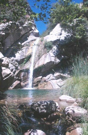
SMD’s late Founder Mary Bowerman’s wish to preserve the Viera ranching family’s property is coming to fruition. The Viera - North Peak parcel is one of the highest in the East Bay with an elevation of 2,300 feet. The property is visible for over 200 miles and includes views of the Sierra, Half Dome and Mt. Whitney. Sharing a 2.5 mile border with Mount Diablo State Park and rising between the two peaks, Viera is the very heart of Mt. Diablo.


Land Use Planning in 2009 - Protected 1,112 Acres

On a weekly basis Save Mount Diablo monitors 35 different planning agendas and, in 2009, responded to 42 different development projects around Mt. Diablo - from cell tower proposals and small subdivisions all the way to reuse of the Concord Naval Weapons Station, Los Vaqueros reservoir expansion, and threats to the Urban Limit Line. In addition to such land preservation projects, six other projects were stopped or withdrawn, totaling 1,112 acres. We continue to watchdog the remainder.

• Northgate - A proposal in the Northgate Area of Walnut Creek, to subdivide a steep hillside property covered by a beautiful grove of blue oaks jutting into Shell Ridge Open Space, was withdrawn. The addition of four new houses on this property would have destroyed the scenic value and altered the rural character of the area while also impacting preserved habitat in Shell Ridge.

• Morgan Territory - The proposed subdivision of a property located across Morgan Territory Road from Mt. Diablo State Park, and crossed by a creek tributary, would have impacted endangered species habitat and scenic resources. Save Mount Diablo submitted comments opposing the subdivision and the application was also withdrawn.

• Communication Towers - Each new tower proposal is an opportunity. As newer towers are proposed, Save Mount Diablo urges the removal of old towers no longer in use, resulting in the consolidation and overall reduction of towers on the landscape. In 2009, Save Mount Diablo negotiated the removal of 7 old towers in exchange for the construction of two new ones, providing an overall benefit to aesthetic views while also minimizing threats to bird species.

• Alamo, Antioch & Blackhawk – Even when open space is protected it must be defended. In four different projects last year, SMD defended against attempts to develop or encroach upon homeowner open space.

• Concord Naval Weapons Station – After years of planning and input from Concord residents and the Community Coalition for a Sustainable Concord, of which SMD is a member organization, the City Council voted to move two alternatives forward, including a minimum of 3,200 acres of parks and open space. The plan should protect Mt. Diablo creek and the Los Medanos hills in a new regional park bigger than Tilden, while also creating a large network of parks around development centered on the North Concord-Martinez BART Station. Years more work will be needed.

• State Park Closures - As a member of the Save Our State Parks coalition, SMD helped block Governor Schwarzenegger from closing over 200 state parks, including Mt. Diablo and 46 other parks in the Bay Area.

• Tassajara Hills - Applications were withdrawn for four subdivisions – totaling 1,102 acres of rolling grassland in the Tassajara hills. These projects would have lead to fragmentation of wildlife habitat and corridors, while also impacting East Bay Regional Park District’s planned Doolan Canyon/Tassajara Hills Regional Park.

• Tassajara Valley - Save Mount Diablo has formed a coalition to defend the Tassajara Valley from development threats like “New Farm” – a proposal to build 186 houses and a cemetery on 771 acres outside of the Urban Limit line. This plan would bust the line, opening thousands of acres of natural lands and sensitive habitat to development threats.

Yuba developer agrees to conservation deal...

TPL and Owner of Yuba Highlands Create Conservation Easement

http://yubanet.com/regional/Trust-for-Public-Land-and-Owner-of-Yuba-Highlands-Create-Conservation-Easement.php

April 13 2010
TPL has worked for several years behind the scenes with the Gallelli Family (owners of the proposed Yuba Highlands project) and multiple public agencies to help create a conservation outcome on Yuba Highlands that should benefit the Spenceville Wildlife Area and Beale Air Force Base.
The idea is to create a conservation easement on as much of the 2,600 acre Yuba Highlands property as funding will allow.

The first parcels on which the easement will be placed are approximately 700 acres along Smartville Road just North of Beale AFB that would link up the two separate areas of Spenceville Wildlife Area. The proposed easement terms would eliminate development rights and allow limited public access consistent with common grazing operations

Independence Lake north of Tahoe bought for public from power company

2325 acres of Land around and including lake ten miles north of Truckee is saved by NC

http://www.nature.org/wherewework/northamerica/states/california/features/independence.html

On May 11, 2010, The Nature Conservancy announced that Independence Lake, one of the most pristine alpine lakes west of the Rockies, and the majestic wilderness that surrounds it will remain protected from development following the sale of the lake and the land to The Nature Conservancy by longtime owner NV Energy. (The property lies on both sides of the Sierra and Nevada County lines)

http://www.sfgate.com/cgi-bin/article.cgi?f=/c/a/2010/05/20/SP5F1DG9ES.DTL#ixzz0oTibY9NH

--------------------------
Land buy around Calif. lake to ease Truckee Meadows droughts, Reno-Gazette Journal
http://www.rgj.com/article/20100510/NEWS/100511001/-1/CARSON/Land-buy-around-Calif.-lake-to-ease-Truckee-Meadows-droughts


May 10 2010--The purchase announced Tuesday of thousands of acres around Independence Lake by The Nature Conservancy will protect a critical source of water for Reno and Sparks in times of drought, states a member of the organization .The Nature Conservancy’s $15 million purchase of 2,325 acres of forest land in the Sierra Nevada from NV Energy will also preserve one of only two lakes in the world with indigenous populations of the threatened Lahontan cutthroat trout, said Chris Fichtel, Independence Lake project manger for The Nature Conservancy.


http://www.rgj.com/article/20100518/TT/5180302/1047


May 18 2010--Last week the Nature Conservancy purchased 2,325 acres of land around Independence Lake north of Truckee for $15 million. The Conservancy called the 2.4-mile-long lake one of the most pristine alpine lakes west of the Rockies and home to one of the world's last two wild lake populations of the Lahontan cutthroat trout and other wildlife species. The acquisition was billed as a move that would "protect a critical source of water for Reno and Sparks in times of drought," but the rights to the 17,000-acre-feet of water in the lake were never threatened, and the acquisition did nothing to change ownership of the water itself. The Conservancy purchased the land from NV Energy, the utility that has owned the property since 1937, but the water in the lake remains in the hands of the Truckee Meadows Water Authority, which uses the lake as a reserve for times of severe drought.

4000 acre conservation easement bought from timber giant north of Tahoe

Sierra Pacific Industries stops some clearcutting for $8 million 

http://www.theunion.com/article/20100628/NEWS/100629756/1001&parentprofile=1053

MAP: https://picasaweb.google.com/rexfrankel/CentralValleyAndSierraNevadaMountainsNewParks#5659392895524414002

6/28/2010--Most recently, working with the Trust for Public Land, the group scooped up more than 4,000 acres (with plans for 7,000 acres) in conservation easements on Sierra Pacific Industries' land north of Truckee, the first-such conservation deal ever brokered with the lumber company.

“This is not just the conservation and protection of over 7,500 acres in the Little Truckee Watershed — we have consummated a conservation transaction with the largest private land owner in California,” said Perry Norris, executive director of the Truckee Donner Land Trust. “That's precedent setting.”

The private property runs in a checker pattern of public (U.S. Forest Service) and private land along the historic Henness Pass Road, running from west of Highway 89 north to the hills around Jackson Meadows Reservoir.

The easements prevent clear-cutting and the use of herbicides, still allows some timber harvest and opens the Sierra Pacific Industry land to the public and allow trail building, said John Svahn, stewardship director with the land trust.

And it was possible with $1.83 million from the Northern Sierra Partnership and $6.42 million from the Wildlife Conservation Board, Norris said.

http://www.nevadaappeal.com/article/SS/20100625/NEWS/100629952/0/NEWS&parentprofile=
for story and map
---------------------------
NOTE: this map is very fuzzy even when enlarged. The lake on the left is Jackson Meadows Reservoir. The lake on the right side is Webber Lake.
----------------------

more:
excerpted from

Thousands of Sierra acres conserved in new deal
http://www.rgj.com/apps/pbcs.dll/article?AID=20107120331
7/13/2010

The Truckee Donner Land Trust is in the business of conserving open space, and business is good. The down economy that has many other non-profits cutting back and bunkering down has created unique land acquisition opportunities for the group founded in 1990 in the Sierra Nevada north of Lake Tahoe. Most recently, working with the Trust for Public Land, the group scooped up more than 4,000 acres in conservation easements on Sierra Pacific Industries' land north of Truckee -- the first-such conservation deal ever brokered with the timber company.

Plans call for the addition of another 3,000 acres as part of the package that primarily straddles watersheds for the Little Truckee River and the Yuba River. It includes sections of the Pacific Crest Trail on its way from Mexico to Canada....

The private property runs in a checkerboard pattern of national forest land and private land along the historic Henness Pass Road, running from west of California 89 north to the hills around Jackson Meadows Reservoir. The easements prevent clear-cutting and the use of herbicides while still allowing some logging and opening the nearly 12 square miles of land to public access and potentially new trail construction, said John Svahn, stewardship director with the land trust.

...Norris said the first-ever conservation easement with Sierra Pacific Industries also possibly prevents serious development in the forests north of Truckee.
"This is the same 7,500 acres SPI was petitioning Sierra County to take out of timber production zone and put into general forestry, which means it could have been subdivided into 160-acre ranchettes," Norris said.

...He said Sierra Pacific Industries has transferred more than 100,000 acres to public ownership in the past, but compared to an outright sale or transfer, the conservation easements along Henness Pass mean SPI can continue to harvest wood for mills in the area, keeping jobs in the northern Sierra...

Butte and Tehama update...

North California Regional Land Trust news—Spring 2010

http://landconservation.org

PROJECT UPDATES
NCRLT is working on seven conservation easements that would protect approximately 750 acres of prime farmland. 7,132 acres of oak woodland and working rangeland, and 877 acres of vernal pool grassland in Butte and Tehama. counties. The following are project highlights:

The culmination of NCRLT’s Irrigated Farmland Protection Project, which began in June of 2007, has been the submittal of four applications for easement funding to both the California Farmland
Conservation Program (CFCP) and Natural Resources Conservation Service (NRCS).

• NCRLT is hoping to close escrow on the ‘Red Bank Project” in 2010. This project consists of two adjacent ranch properties locatedwest of Red Bluff in Tehama County, which together comprise 7,130 contiguous acres of primarily blue oak woodland.
• NCRLT is currently working on three mitigation projects which would permanently protect approximately 877 acres of vernal pool grassland, perennial and intermittent streams, and riparian woodland. These natural communities support several state and federally protected species, including vernal pool tadpole shrimp, vernal pool fairy shrimp, Green’s tuctoria, Swainson’s hawk, western burrowing owl, and Western spadefoot toad.


http://landconservation.org/UserFiles/File/NewsletterSpringTBFinalLowRes.pdf

Sunday, June 27, 2010

West Mono Basin--135 acres saved...

ESLT Receives conservation Easement near Mono Lake

5/5/2010--Mono County landowner, Jan Simis, has permanently preserved her 135 acres for future generations. Her land, which sits at the very western edge of the Mono Basin, has now been preserved with a conservation easement, a voluntary binding land protection agreement between the landowner and Eastern Sierra Land Trust (ESLT).

http://easternsierralandlines.wordpress.com/2010/05/05/mono-basin-traditions-preserved/

an Addition to a Mendocino Redwoods park...

200 acres of redwood donated to BLM by Save the Redwoods League

The Willits News, 5/14/10
"Save the Redwoods League has announced acquisition and transfer of two redwood parcels totaling 200 acres to the federal Bureau of Land Management. Bordering Montgomery Woods State Natural Reserve, the parcels serve as a buffer zone to help preserve the area's biodiversity, including the largest grove of old-growth redwood forest in Mendocino County" and "also will provide protection for rare, threatened or endangered species, including marbled murrelets, Coho salmon, steelhead trout and red-bellied newts. The land will be cooperatively managed by BLM and California State Parks."

http://www.willitsnews.com/ci_15087043

Canyon north of the Rose Bowl is saved...

AFC has Acquired 20 Acres in Historic Rubio Canyon!

http://www.arroyosfoothills.org/

Thanks to you, in 2009, the Arroyos + Foothills Conservancy purchased 20 acres of prime habitat at the mouth of beautiful and rugged Rubio Canyon. This key parcel secures public trail access and ensures that Rubio Creek and surrounding chaparral and oak woodland right up to the Angeles National Forest will be preserved for all time. A portion of the historic Pacific Electric Railway bed, part of the famous Mt. Lowe Railway, lies on the property.

We were able to move quickly to buy this property because we had funds in the bank. Now, we need to raise additional money so AFC can be ready to move quickly the next time a conservation-minded landowner comes to us with an urgent land sale. Having money in the bank enables us to act fast when opportunities for land preservation occur. We also need to raise a modest endowment to pay for the cleanup and upkeep of the Rubio Canyon land.

You can make a secure on-line donation right now by going to http://www.arroyosfoothills.org/support.html.

Nail finally put in coffin of Newhall Pass development

State Supreme Court reaffirms Las Lomas defeat (on 12-17-09)

http://www.the-signal.com/archives/22410/

12/21/2009--The California Supreme Court denied the final appeal of the Las Lomas development on Dec. 17, 2009, upholding the lower court's ruling in favor of the city of Los Angeles.

This important ruling finally exhausts Las Lomas' ability to move forward with its mega-development project.

Las Lomas, proposed by developer Dan Palmer, sought to add 5,500 homes, two million square feet of commercial space, and a 300-room hotel in the Newhall Pass where the 5 and 14 freeways converge.

"The city of Santa Clarita has long opposed the Las Lomas project and worked successfully with the city of Los Angeles to stop it due to the magnitude of its potential impact and mountainous location in the Newhall Pass," said Santa Clarita Mayor Laurene Weste.

On Aug. 28, 2007, the Santa Clarita City Council unanimously adopted a resolution opposing the city of Los Angeles entering into a supplemental fee agreement with the developers of the large Las Lomas development project.

Though the project site abuts the city of Santa Clarita and is within Santa Clarita's adopted General Plan area, the developer attempted to annex to Los Angeles. A supplemental fee agreement would allow for the expedited review of the Las Lomas project by the city of Los Angeles.

The Santa Clarita City Council's concerns stemmed from the fact that the Las Lomas development would exceed the county's and Santa Clarita's adopted density for the site by more than 1,000 percent.

The proposal also conflicted with Santa Clarita's application with the Local Agency Formation Commission to amend its sphere of influence. Santa Clarita sent the resolution, along with a letter, to the mayor and City Council of Los Angeles.

Big Wanna-be Ventura Developer flexes his muscles...

Landowner Tries to close long-used trail to Ventura's Matilija Falls


The land surrounding the trail to the waterfall is owned by Shull Bonsall, who also owns a 6500 acre ranch called Canada Largo which he is seeking to urbanize and annex to the city of Ventura


from the 6/27/2010 LA Times
http://www.latimes.com/news/local/la-me-adv-matilija-falls-20100627,0,6339818.story

PHOTOS:
http://www.latimes.com/news/local/la-me-matilija-pictures,0,2145734.photogallery

----------------------

Landowner Shuts Off Public Access to Popular Matilija Falls Trail Near Ojai

http://www.lpfw.org/news/1004matilijatrail.htm


map and photo

-----------------------------
MORE ON THE LANDOWNER:

Development proposal for the Canada LArga ranch:
http://www.vcstar.com/news/2010/may/03/hillside-group-fighting-growth-plan/

District attorney stops work at tributary to Cañada Larga Creek --Ventura County Star

http://m.vcstar.com/news/2010/may/05/district-attorney-stops-work-at-tributary-to/

5/5/2010-- Without admitting any wrongdoing and in lieu of paying civil penalties, Bonsall agreed not to violate the law in the future and to donate two acres of land along the Ventura River to the Ventura Hillsides Conservancy, McWaters said.

Thursday, June 24, 2010

SF Bay Ridge Trail system is 53% complete--325 miles are open!

Bay Area Ridge Trail Enjoys Unprecedented Coverage in Bay Area News Group Papers 

--Plus two new sections opened in the last month!


from Sunday, May 30, 2010 issue:
Check out Paul Rogers' in-depth feature story on the Ridge Trail, plus these online extras:

325 miles are completed and open to the public, out of the total planned 610 miles


http://www.mercurynews.com/bay-area-ridge-trail

http://www.mercurynews.com/top-stories/ci_15159951

Interactive Map with photos and video
http://www.mercurynews.com/bay-area-ridge-trail#map


Slide Show

http://extras.mercurynews.com/slideshows/news/2010/05/BayAreaRidgeTrail/


http://www.insidebayarea.com/ci_15185963
Bay Area Ridge Trail about two-thirds complete in San Mateo County
----------------------

http://www.marinij.com/bayarearidgetrail/ci_15161285
Mountain bicyclists feel left out by restrictions on Bay Area Ridge Trail
---------------------------

The Dias ridge trail opened May 8th, 2010 in Marin County


----------------------------------------

702 acres of new open space +1.5 miles of new Ridge Trail in Contra Costa County


http://www.muirheritagelandtrust.org/assets/pdfs/directions/Fernandez%20directions.pdf

The 702-acre Fernandez Ranch, purchased by the Muir Heritage Land Trust in 2005 with funding assistance from the Bay Area Ridge Trail Council, has undergone a major restoration project.

Highlights include a new staging area, picnic areas, 156 ft. clear span bridge, large-scale creek restoration, more than 10,000 native plants and trees, 3.5 miles of multi-use trails including sections accessible to people with disabilities and an important new 1.5-mile segment of the Bay Area Ridge Trail.

Close ties revealed between oil regulators and those who would wreck L.A.'s planned Baldwin Hills urban mega-park

Oil v Parks in L.A.

3/15/2010--LOS ANGELES (AP) — This sprawling metropolis is built atop one of the richest oil basins in the world. Wells dot the city landscape, some hidden behind hollow building facades much like a Hollywood movie set, or,  in the case of Beverly Hills High School, encased in a tower painted with flowers.

For decades it had been assumed that one oil field, the historic Inglewood, just minutes from the downtown skyline, would eventually play out, that the nodding pumpjacks would give way to an elaborately planned, two square-mile park.

But in 2004 Houston-based Plains Exploration & Production Co., which had acquired the drilling rights from Chevron, used new technology to discover that only 35 percent of the reserves had been pumped out and began to drill the first of what would eventually become 600 new wells over the next 20 years. This renewed push for oil was helped along by county and state regulators who determined that the additional
wells didn't require any environmental review.

One state engineer charged with granting new permits apparently saw himself as more of a cheerleader for Plains than an impartial regulator, according to e-mails acquired by the Associated Press and an investigation by the state auditor. Not only did he own stock in the company whose wells he was approving, he solicited donations from the oil companies he regulated for his wife's nonprofit.

"Just keep up the good work," state regulator Floyd Leeson wrote to a high-ranking Plains' official in March, 2005, "and I will TRY to keep (my boss) from hitting you guys with any more retarded fines … Remember, I'm on YOUR side … go PXP!"...

for full story:

http://www.cityprojectca.org/blog/archives/3750

More SM National Park purchase $$$$?

Thursday, March 25, 2010

SHERMAN REQUESTS ADDITIONAL FUNDS FOR SANTA MONICA MOUNTAINS NATIONAL RECREATION AREA

WASHINGTON, DC– Congressman Brad Sherman (D-Sherman Oaks) testified today in the House
Appropriations Committee in support of his request for additional land acquisition funding to expand the Santa Monica Mountain National Recreation Area.

Sherman appeared before the House Interior and Environment Appropriations Subcommittee to request
funds to protect core habitat in Zuma and Trancas Canyons in the Santa Monica Mountains National Recreation Area, calling it his top priority for the Fiscal Year 2011 Interior and Environment Appropriations Act. The Department of the Interior Fiscal Year 2011 Budget provides $3.75 million to acquire 16 tracts of
and, but Sherman is urging the Committee to increase the amount to $6 million so that an additional 12 tracts may be purchased.

"Hiking trails within the canyons provide scenic views of the Pacific Ocean, numerous waterfalls, and
natural solitude, and additional land acquisition funds would help secure critical recreational trail connections for the public to enjoy," said Sherman . "However, high-end real estate development on private in-holdings threatens to displace critical habitat and degrade park scenery and coastal water quality."

Subcommittee Chairman Jim Moran (D-VA) echoed Sherman 's argument, concurring that, due to the
struggling economy, now is the time to acquire available lands. If land is not acquired now, mansions will be built on the property and we will not be able to buy the land, he said.

Each year over 33 million visitors enjoy the Santa Monica Mountains National Recreation Area's
renowned beaches and explore the park's mountains, including its 60-mile Backbone Trail, which stretches across the Santa Monica Mountains and traverses through Zuma and Trancas Canyons . To date, the National Park Service has acquired 22,000 acres of parkland using Land and Water Conservation
Funds totaling $163 million.

The Santa Monica Mountains National Recreation Area has one of the largest backlogs of
acquisition needs in the national park system. Approximately 20,595 acres remains to be acquired to complete the Land Protection Plan recommendations. The value of these lands is estimated to be over $57
million.

Sagebrush Island in north Orange County is spared --for now

Fullerton's City Council rejects the Chevron Corporation's Coyote Hills development

"FULLERTON – The City Council voted 3-2 Tuesday  night (5/25/2010) to deny a massive, controversial development proposal by Chevron-owned Pacific Coast Homes. A grass-roots campaign to stop the development has been underway for almost a decade – but the decision was a surprise to many at the
meeting. About 250 opponents and proponents of the 760-home West Coyote Hills development attended the meeting.

The affected piece of land is huge – 510 acres, with the swath running along Fullerton's northern border and largely covering small, rolling hills. The land is mostly vacant. Councilman Richard Jones and
Mayor Don Bankhead voted in favor of the developer, while council members Pam Keller, Shawn Nelson and Sharon Quirk-Silva voted to deny the proposal.

"We're disappointed in the decision," said Jim Pugliese, project manager for Pacific Coast Homes. "We will be determining what our options are, and when we know what our options are, we'll be letting
folks know."One possible option is for the developer to come back a modified version of the plan...."
http://www.ocregister.com/news/development-250469-council-land.html

--------------------
http://www.coyotehills.org/

BACKGROUND:
 
1.  The land itself is the coastal sage scrub (css) ecosystem that is going into extinction.  Only 5 to 10% is left in the world (all in CA and northern Baja).  This Fullerton part of the ecosystem can become a self-sustaining preserve when the rest goes into extinction (due to it being a great place to build houses), but only if it remains above 500 acres.  (Currently there's 582 acres which includes the City-owned Robert Ward Preserve park.) However, Chevron, Corp. wants to build houses and save only 55% of the acreage as pathways along the backyards of people's homes.  A cactus garden they will have, but not a true CSS ecosystem.

-- Recently discovered Coyote Hills Earthquake Fault connected to the Puente-Chino Hills Blind Thrust Fault is location of houses, with densest development being in the major liquefaction zone, causing slide liability that taxpayers will have to pay for.
--Problems of building on an unsatisfactorily cleaned up oil/gas field (with houses to be methane-vented) for which there is a possibility Chevron will resume pumping using the slant-drill method.
--Money is available to purchase the land as a park, but Chevron, Corp. refuses to talk to the people with the dough.

East L.A. County wild spot threatened --public ownership does not always =protection

Diamond Bar to hear public's input on 30-acre site proposed for development

http://www.sgvtribune.com/ci_15296462

By James Wagner, San Gabriel Valley Tribune, June 14, 2010

DIAMOND BAR - Mary Rodriguez insists her neighborhood will change for the worse if the city approves its plan for a plot of 30 acres known as "Site D."

"Everybody that I've talked to is opposed to it," she said, of her neighbors.

Rodriguez, who lives adjacent to the site, has handed out hundreds of fliers and is planning on posting two five-foot long posters nearby warning of what she says will be increased traffic and noise.

The City Council at its meeting tonight [June 15] is scheduled to consider an environmental impact report and specific plan for the plot at Diamond Bar Boulevard and Brea Canyon Road.

The city hopes Site D could eventually hold a mix of 154,000 square feet of commercial space and 202 residential units.

The majority of the 30 acres is owned by the Walnut Valley Unified School District. The city owns about an acre and the Los Angeles County Flood Control District about two-thirds of an acre....

--more info here:

http://www.nositedsp.com/

S.M. Mountains Park linkage is completed

"FIREHOUSE HILL" HAS BEEN SAVED!

6/21/2010---from the Sierra Club's Santa Monica Mountains Task Force

"Firehouse Hill" is the 200 acre, 600'-high wooded hillside that dominates the view coming down the Ventura Freeway toward Las Virgenes Road. It is the southern end of a seven-mile-long, 1000'-high ridge extending southward between Cheeseboro Canyon and the former Ahmanson Ranch.

Developers have had this hill in their sights for the past quarter century, with plans at various times to construct over a hundred condominiums and ridgetop mansions, and, at one point, a huge shopping center. Last week, instead, Firehouse hill was purchased by the Santa Monica Mountains Conservancy for $6.25 million, and will now remain natural park land in perpetuity. Former Task Force Co-Chair Margot Feuer once complained of the Santa Monica Mountains that "there was no there there", meaning that there was no major destination in the park to tell visitors they had arrived. The purchase of Soka took care of the "there", but there still hasn't been a real entrance to the park that differentiated it from the developed areas adjoining it. With the purchase of Firehouse Hill the passing motorist will now have no doubt that he has reached protected park land. Firehouse Hill is only a few steps from the Las Virgenes Interchange and an MTA bus stop, but it will be the staging area for over 10,000 acres of state and federal parkland in the upper Malibu Creek watershed.

--------------------------------------------------------------------
http://senweb03.senate.ca.gov/focus/outreach/sd23/sd23-enewsletter-201007.asp

New Park and Some Cute New Constituents (From Senator Fran Pavley's e-news)
Sen. Pavley with Fred Sands and L.A. County Supervisor Zev Yaroslovsky
I was honored to take part in the special dedication of a 200 acre property in Calabasas. The creation of the new park, which was spearheaded by L.A. County Supervisor Zev Yaroslavsky and was named in his honor, was made possible thanks to mitigation funds from the Calabasas Landfill. We are all grateful that property owner Fred Sands became a willing seller and realized the scenic and ecological value of the property for future generations. The site will be owned and maintained by the Mountain Recreation and Conservation Authority arm of the Santa Monica Mountains Conservancy.
New constituents to Senate District 23
The big news of the day came when Santa Monica Mountains National Recreation Area Superintendent Woody Smeck announced that I have three new constituents. Eight-week-old mountain lion cubs were recently born in the Agoura Hills area of the Santa Monica Mountains – proof that wildlife corridors and preservation of open space areas are critical to the survival of our large mammal populations such as mountain lions and bobcats. Each mountain lion kitten has been implanted with a tracking device that will allow researchers to follow the kittens' movement.

Wednesday, June 23, 2010

Sacramento land trust featured in national magazine

The saved 4000 acre Deer Creek Hills 
is featured in national magazine; Land Trust Alliance's Saving Land

A national publication has featured the Sacramento Valley Conservancy in the centerfold of their Summer 2010 quarterly magazine. That's just another reason to take notice and support Sacramento Valley Conservancy's 20th Anniversary and being accredited by the Land Trust Accreditation Commission. We look forward to the next 20 years!

http://www.landtrustalliance.org/about-us/saving-land/summer-2010/land-we-love.pdf

http://www.sacramentovalleyconservancy.org/

Santa Barbara Voters reject oil drilling on coast

ELECTION COMMENTS: THE PEOPLE HAVE SPOKEN!

6/9/2010--The election results of Tuesday night were particularly gratifying for EDC.

First, and foremost, we salute the citizens of Carpinteria for an overwhelming 70% denial of Measure J, a proposed end-run around the City Council for Venoco's Paredon project. All of the legal and procedural protections we depend on to assure environmental protection would be of little value if oil companies can simply purchase an exemption at the ballot box.

http://www.environmentaldefensecenter.org/

San Diego River Purchase is thiiiis close....donate now!

6/10/2010--We are really close!

After 5 years of work, we have reached agreement to purchase our top priority acquisition! This incredible 126 acres is an important wildlife, scenic and recreation property near El Capitan Reservoir in Alpine.

We have just $15,980 to raise to secure this deal. Please consider making a donation today. We have secured funding to purchase the property, but we need to make the deposit first!

Can you donate $10 or more to make this possible?

http://www.sandiegoriver.org/acquisition.php

Roadless Fed Forests Protected Despite Crazy Courts

With courts split, Vilsack acts to preserve Roadless Rule

--Agriculture Secretary extends protections for another year

While federal courts continue to wrangle over the legality of the Clinton-era Roadless Rule governing national forests the Obama administration in May acted once again to safeguard the nation's inventoried roadless areas.

On May 28 Agriculture Secretary Tom Vilsack issued an interim directive preserving roadless area protections for one more year.

"While the courts continue to wrestle with roadless policy," Vilsack said, "I will continue to work to ensure we protect roadless areas on our national forests."

The initial rule protected some 58 million acres of mostly forested roadless areas on federal lands — including 4.1 million acres of national forests in California — from logging, mining, development and road building.

Last summer the 9th Circuit Court of Appeals upheld the 2001 Roadless Rule. The Rule currently is under appeal in the 10th Circuit. A decision on that case could come any day.

"Renewing this directive reflects President Obama's commitment to protecting our forests by ensuring that all projects in roadless areas receive a higher level of scrutiny," Vilsack said.


story continues here:

http://www.forestsforever.org/en2.3story3june2010.html

Help the Feds Help Us Save our Wildlands

http://calwild.org

Dear Wilderness Activist,

I want to invite you to an exciting event that will take place in Southern California on July 8, 2010!
President Obama and his administration have recognized the importance of protecting our great natural treasures by launchingAmerica's Great Outdoors Initiative.

The idea behind the Great Outdoors Initiative is to reconnect Americans to the outdoors by promoting and supporting local, community-based efforts for conservation.

On July 8th, key people from President Obama's Administration will be in Southern California to listen to what YOU have to say about the wild places you cherish the most and what is needed to help protect them!

Thursday - July 8, 2010, 3:00 p.m. to 7:00 p.m.

WHERE: Thorne Hall
Occidental College
1600 Campus Road
Los Angeles, Calif.

MORE INFO:
http://www.doi.gov/americasgreatoutdoors/

310 Acres Saved by land trust in San Luis Obispo

6/16/2010--SLO Land Conservancy and SLO City Successful in Raising Froom Ranch Funds

With over 300 separate donations from the local community, The Land Conservancy of San Luis Obispo
County and the City of San Luis Obispo have surpassed the campaign funding goal to purchase Froom Ranch
for Open Space in the City's expanding Greenbelt. Key to the success of the local campaign were anchor
donors Don & Mary Smith who gave $10,000 at the very beginning of the project, and SunPower Corporation who helped close the deal with a recent $10,000 contribution to the project....

The City of San Luis Obispo's Natural Resources Protection Program and The Land Conservancy of San Luis
Obispo County raised $63,000 in local donations over the last three months to create Froom Ranch Open
Space; a 310 acre property that will offer new recreational opportunities and wildlife viewing in the SLO
Greenbelt.

http://www.lcslo.org/

Yosemite Saved From Road Builder

6/18/2010--Three years of legal struggle by Earthjustice have stopped a developer's plan to build two roads into Yosemite Park. A Fresno judge rejected a land owner and county's claim to right of way under a repealed, Civil War-era law know as R.S. 2477. The roads would have linked Hazel Green's property to Highway 120 within Yosemite, and facilitated its development into a destination hotel and resort.

http://www.earthjustice.org

http://action.earthjustice.org/earthjusticeaction/notice-description.tcl?newsletter_id=20247018

Offroad routes in Kern County Desert are closed

BLM closes two routes at Rand Mountains pending federal court ruling (BLM news release, 6/21/10)

The two routes in question are part of a legal challenge involving the BLM's West Mojave Plan, approved in 2006. The routes had been previously closed as part of an earlier Federal Court settlement. BLM
developed a new plan for the area to protect sensitive resources and still allow vehicle use under permit, but a recent new ruling of the Interior Board of Land Appeals remands the plan to the BLM, pending the outcome of a Federal lawsuit soon to be heard in San Francisco. The closure is expected to impact a significant number of off-highway vehicle recreationists.

http://www.blm.gov/ca/st/en/info/newsroom/2010/june/CDD1078.html

Learn More about wetland restoration in the SF Bay area

http://www.yourwetlands.org/about.php

About the Project
* Brief History
* Wetland Habitat and Other Values
* Wetlands along the North Edge of
San Francisco Bay
* "MISSION 37"

The partners of the San Francisco Bay Joint Venture share a larger common vision for protecting a total of over 200,000 acres of wetlands in the nine counties that surround San Francisco Bay. The goals, habitat types and strategy for the implementation of this vision/plan can be found in Restoring the Estuary.  San Pablo Bay, the north end of San Francisco Bay, offers a unique opportunity to connect large sections of land to protect and restore wetlands in this densely populated Bay Area that have not yet been urbanized. 
In 2005, partners from the San Francisco Bay Joint Venture who have been actively working to protect and restore wetlands in San Pablo Bay came together to find ways to educate the traveling public about the
wetlands and projects along the 17 mile stretch of State Highway 37,  now known as the North Bay Flyway Highway.

101 Highway Widening threatens Humboldt Old Growth Redwoods

Challenging the Caltrans Plan for Richardson Grove

6/23/2010

It's been one week since EPIC and our allies filed a lawsuit challenging the Caltrans plan to widen Highway 101 through Richardson Grove State Park. In addition, we established the Richardson Grove Legal Fund, and made a fundraising challengeto our supporters to match donations and raise $5000 in one week.We have seen great success through the announcement of the lawsuit through favorable and extensive media coverage across the state of California.

In addition, thanks to supporters like you, we have surpassed our kick-off goal of $5000!

Of course, a lawsuit and state wide campaign depend on continued donations. We sincerely appreciate the support and look forward to continue to provide high quality advocacy work in defense of the Humboldt County and the old growth redwoods in Richardson Grove State Park. If you haven't already pledged your support, please take a moment and join the effort.

http://www.wildcalifornia.org/blog/challenging-the-richardson-grove-plan-its-just-the-beginning/ 

-----------------------------
Defending the beauty and biodiversity of California's fabled "redwood curtain," the Center for Biological Diversity and allies sued the California Department of Transportation last week for approving a project to widen the highway going through Humboldt County's Richardson Grove State Park, an ancient-redwood haven. In approving the project -- which would cut through and pave over the life-giving roots of nearly 100 ancient redwood trees -- Caltrans violated the state's premier environmental protection law, the California Environmental Quality Act. The environmental impact report for the project fails to acknowledge the full extent of the project's impacts, including the effects of damaging the network of roots holding Richardson Grove together, stockpiling lead-contaminated soil in an area draining to the designated "wild and scenic" South Fork Eel River, and opening the road to larger trucks.
Opposition to the highway project has mounted exponentially since it was proposed in 2007 -- including more than 25,000 comments sent in by Center supporters and other concerned citizens. Center Conservation Director Peter Galvin says, "The state's failure to follow the law puts these old-growth trees and the endangered species that depend on them at unacceptable risk -- all for the sake of letting a few more big trucks use this stretch of highway."
Read more in the Times-Standard.

Friday, June 4, 2010

L.A. Sludge v. Kern sprawl...more border wars

Here we have Kern County being a bad neighbor to L.A. by approving thousands of homes on the County line at Tejon Ranch. And we have L.A. still trying to dump millions of tons of sewage sludge on a ranch near Bakersfield.

High court refuses to review L.A.'s petition in Kern County dumping case

June 2, 2010 -- Louis Sahagun
http://latimesblogs.latimes.com/lanow/2010/06/high-court-rejects-las-petition-over-dumping-of-waste-in-kern-county.html

The U.S. Supreme Court has refused to review a Los Angeles petition that claimed a voter-approved ban on dumping processed human waste in Kern County violated federal interstate commerce laws.
The Supreme Court declined review Tuesday without comment, letting stand a previous 9th U.S. Circuit Court of Appeals decision that the operations were not protected by federal interstate commerce laws because they involved transfers of a commodity – bio-solids -- from one portion of the state to another.
Now the case will return to U.S. District Judge Gary Feess in Los Angeles, and he must decide whether to retain jurisdiction over remaining state-level claims against the ban, or turn them over to a state court.
Those claims include that the ban known as Measure E exceeds its own policing powers by exerting control over another government entity, and is preempted by state recycling regulations.
Kern County wants the 4-year-old case resolved in state court, which would force Los Angeles to decide whether it wants to start the legal briefing process all over again. Los Angeles, however, would prefer that Feess retain jurisdiction and reaffirm his earlier ruling that the ban impedes interstate commerce.
If Kern County prevails, Los Angeles will have to haul 500,000 tons of sludge a year hundreds of miles to landfills in Arizona at an estimated cost of $4 million, according to the city’s petition.

Another view:
http://www.bakersfield.com/opinion/editorials/x1008890595/Sludge-ruling-is-a-breath-of-fresh-air-for-Kern

--------------------------------
A commenter left this website for our readers, http://sludgevictims.com/

Wednesday, June 2, 2010

SCC 9/2009 to 5/2010: Coastal land buys

May 2010 Purchases by Coastal Conservancy Will Save 1428 Acres in Santa Cruz, Del Norte, Humboldt and Marin Counties

Meeting date: Thursday, May 27, 2010

3.9 acres—Santa Cruz County--Consideration and possible Conservancy authorization to augment the Conservancy’s November 6, 2008 authorization to the Land Trust of Santa Cruz County to include an additional acquisition parcel and restoration planning for Watsonville Slough, Santa Cruz County.


160 Acres—Del Norte County--Consideration and possible Conservancy authorization to disburse up to $70,000 to the Northcoast Regional Land Trust to conduct pre-acquisition planning for a conservation easement on the 160-acre Wetherell Dairy in Fort Dick, Del Norte County


fee title to the 40-acre Senestraro property in Eureka, Humboldt County,


Consideration and possible Conservancy authorization to disburse up to $1,000,000 to the Marin Agricultural Land Trust to acquire an agricultural conservation easement over the 1214-acre J. Corda Ranch five miles west of Novato, Marin County.

------------------------------------------

Why No Posts on this since 12/2008?

Due to the State’s budget crisis, virtually no land was purchased by the Coastal Conservancy in 2009 and early 2010.
There were no land purchases at the 2/4/10, 12/3/09. 10/29/09, 6/4/09, 4/2/09, or 2/26/09 meetings

Here are the two that occurred in 2009:

Meeting date: Thursday, September 24, 2009

Consideration and possible Conservancy modification of the prior Conservancy authorization to disburse up to $5,500,000 to the City of Rancho Palos Verdes to acquire 160.5 acres of the Upper Filiorum Property to help implement the City’s Natural Communities Conservation Plan, Los Angeles County.


Consideration and possible Conservancy authorization to accept $5.85 million from the National Oceanic and Atmospheric Administration of the United States Department of Commerce and disburse up to $13.85 million towards the acquisition of interests in the 5,630 acre Jenner Headlands property in western Sonoma County.
http://www.scc.ca.gov/webmaster/ftp/pdf/sccbb/0909bb/20090924Board06_Jenner_Headlands.pdf


------------------------------------

Here are two that occurred in the April 1, 2010 meeting:

http://www.scc.ca.gov/webmaster/ftp/pdf/sccbb/1004bb/index.htm


Consideration and possible Conservancy authorization to disburse  up to $1.2 million from the National Oceanic and Atmospheric Administration of the United States Department of Commerce and $1,136,000 to the County of Santa Barbara for the acquisition of the Paradise Beach property, Point Sal, northern Santa Barbara County.

Consideration and possible Conservancy authorization to disburse up to $1,000,000 to the Muir Heritage Land Trust for: 1) the acquisition of the approximately 483-acre Franklin Canyon property, Contra Costa County, for open space, public access, watershed protection, wildlife and habitat protection, and limited agricultural use; and 2)  planning and resource assessment activities necessary to protect the property.

LA meetuphikes.org

E-Mail the editor:

rexfrankel at yahoo.com

Blog Archive

Quick-Search of Subjects on the Site